Today from the blog of Málaga Viajera we will take a tour of El Caminito del Rey, this natural wonder, partly shaped by the hand of man.
After a long period of neglect and thanks to the restoration planned by the Provincial Council of Malaga and in collaboration with the European Regional Development Fund, in March 2015 the rehabilitated Caminito del Rey opened its doors to the public.
Since then, and with an average of more than 300,000 visitors per year, it has been a tourist and economic revolution in this inland area of the Province of Malaga, which has helped visitors to El Caminito del Rey to take the opportunity to see the surrounding villages, which have a lot to offer in terms of historical heritage, gastronomy and nature.
El Caminito del Rey and its surroundings are preparing their candidacy to become part of the UNESCO World Heritage.
If you are thinking about a getaway or a trip to Malaga and its province, from Malaga Viajera we want to help you to organise your totally personalised trip so that you can enjoy a unique experience. Shall we start?
Where is it located?
About 60 km. from Malaga Capital, its location extends over 3 municipalities in the centre of the province of Malaga, Alora, Antequera and Ardales.
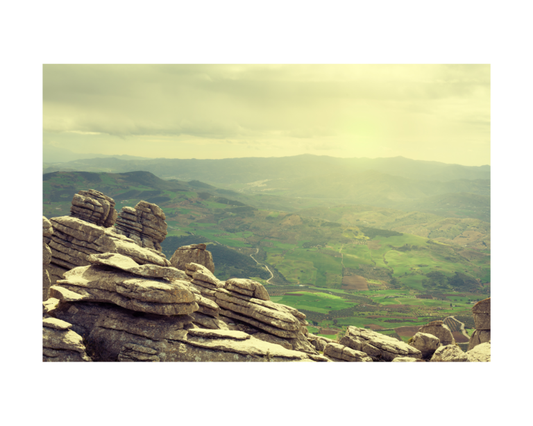
Within the Natural Park of Desfiladero de los Gaitanes, you can find this impressive route through a narrow pass, over almost vertical walls and where it can reach a depth of up to 700 metres, where you can enjoy breathtaking views.
Brief History
El Caminito del Rey, is a passage between gorges created by the erosion of the river Gualdalhorce and
It was built at the beginning of the 20th century when the Sociedad Hidroeléctrica del Chorro decided to connect the two waterfalls, that is to say, the Chorro and the Gaitanejo waterfalls.
By the way, the name Caminito del Rey, comes from the inauguration of the reservoir of the Conde de Gualdalhorce in 1921, which was attended by King Alfonso XIII, making a tour along this path and from there, it began to be called as we know it today.
Route
The total distance is 7.7 km. and will take us between 3 or 4 hours to complete. As it is a one-way route (it is not possible to return along the same route), we will have the possibility of returning by shuttle bus to the entry point.
The route can be divided into 7 parts:
1. Entrance point
Here is the entrance (Restaurante el Kiosko) and one of the shuttle bus stops, from here you can choose 2 routes, one of 2.7 km (Senda de Gaitanejo) and another of 1.5 km (Pista de Gaitanejo) which will take you to the Gaitanejo dam.
During this route you will be able to see 3 reservoirs, the Guadalhorce, the Guadalteba and the aforementioned Gaitanejo.
Along this route you will find a viewpoint and eating areas.
Perhaps the most emblematic point is the Sillón del Rey, an armchair, a table and two stone benches where King Alfonso XIII signed the completion of the works of the Conde del Guadalhorce reservoir.
At the same time, and as we have already mentioned, we will choose the route to follow:
2.7 km (Senda de Gaitanejo)
1.5 km (Gaitanejo Track)
2. Reception for visitors to the Gaitanejo reservoir
Once at this point we will arrive at the Visitor Reception Centre (old building that used to house the Gaitanejo Hydroelectric Station), at this point we must hand in our tickets, you will be given a helmet for the visit and we will be given information to bear in mind.
Once past the Hydroelectric Station, you will be able to see the Cave Houses, which were used by the workers who built the dam.
3. First canyon
Here we will be able to see the splendid landscape from a viewpoint, we will continue along the first wooden footbridge where we will be astonished by the narrowness (barely 10 metres) between the two walls of the gorge. The route is 2.9 km long.
4. Second canyon
At this point, we will cross the Puente del Rey (King’s Bridge), which was intended to connect the railway track and the slope of the Tagus.
Afterwards, we will pass by the Cueva del Toro and the Mirador de Las Rocas.
5. The Hoyo Valley
We enter an environment with a lot of vegetation and where the river slows down and creates some ponds. At the end of this section you will find the Canal Gate.
6. Third canyon
This section is done by means of footbridges anchored to the wall at a height of 100 metres, further on we will cross over the Hanging Bridge.

7. Final section
This section runs along a downhill path for just over 2 km, at the end of which you will find the El Chorro train halt.
I am sure you will find this visit spectacular and enjoy an unforgettable experience.
Ticket prices
You can buy your tickets through the official website https://reservas.caminitodelrey.info/, please note that you have to book well in advance, there are 3 types of tickets:
- General (free visit) 10 € per person.
- Guided tour: 18 € per person.
- Last minute: Tickets available for unused travel agency seats and available 3 days before the date.
- The price of the shuttle bus is 1,55 € per person.
Very important: Children under 8 years old cannot access the Caminito del Rey.